In Arizona, I was now three hours behind Eastern Daylight Time, since Arizona does not observe daylight saving time. This makes it even easier to be up and out of the hotel early. Unfortunately, I had wanted to get some food before I left the hotel, but weekend breakfast hours were too late to make it worthwhile. Given how the day would turn out, I am glad I didn’t delay departure for an hour.
The first checkpoint of Saturday was the Elden Pueblo Archaeological Site, just a short hop from the hotel. Perhaps my delay in getting there was telling of how the rest of the day might go–I got stuck at a double railroad crossing. As one train nearly completed crossing, a train coming the opposite direction held me up even longer. There was no way around it either. The archaeological site, located in a campground, was not much to look at from the parking lot–the rock structure in the distance was all I had time to see.
The terrain, though, is very much Flagstaff, one reason I like the area so much. For those who are not aware, Flagstaff, being in Arizona, is much higher in elevation than points to the south (Phoenix, Tucson, etc.), so the climate is very similar to where I live. But, the skies are clearer, and the humidity is much lower. The air is also cleaner, and Flagstaff is an International Dark Sky City, so the light pollution at night is nearly non-existent.
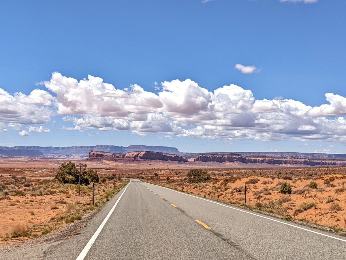
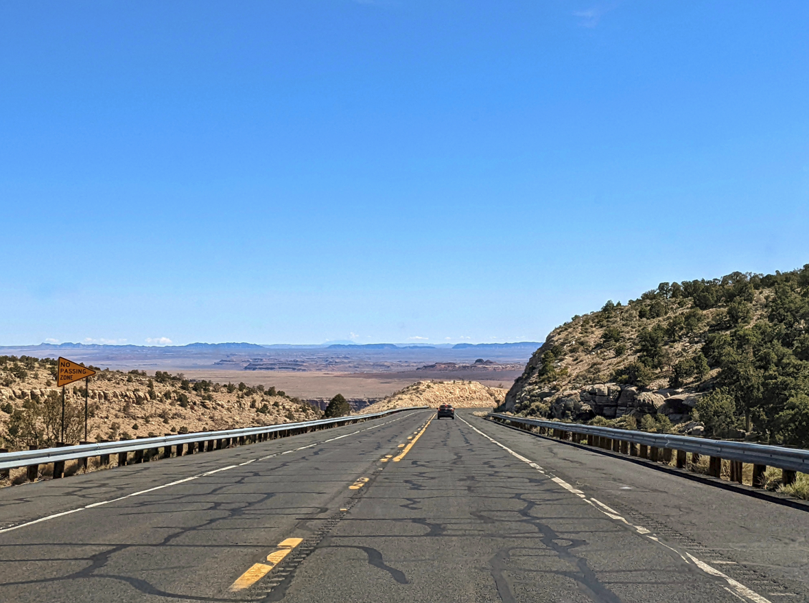
Back on the rally route, I had to trick my navigation, as it kept wanting me to take US-89 north out of Flagstaff which was closed due to the Tunnel Fire. Our official detour was to take US-180 to AZ-64, which heads straight north and makes an eastward turn.
If you are familiar with the area, you already know where I’m headed. It’s a beautiful drive on a two lane road, down a corridor of ponderosa pines and. At this early hour, not a lot of tourists are on the road. Where we approach the right turn onto AZ-64 is a very well known landmark in the US.
There’s Duck Rock. Right where I left it in 2017.
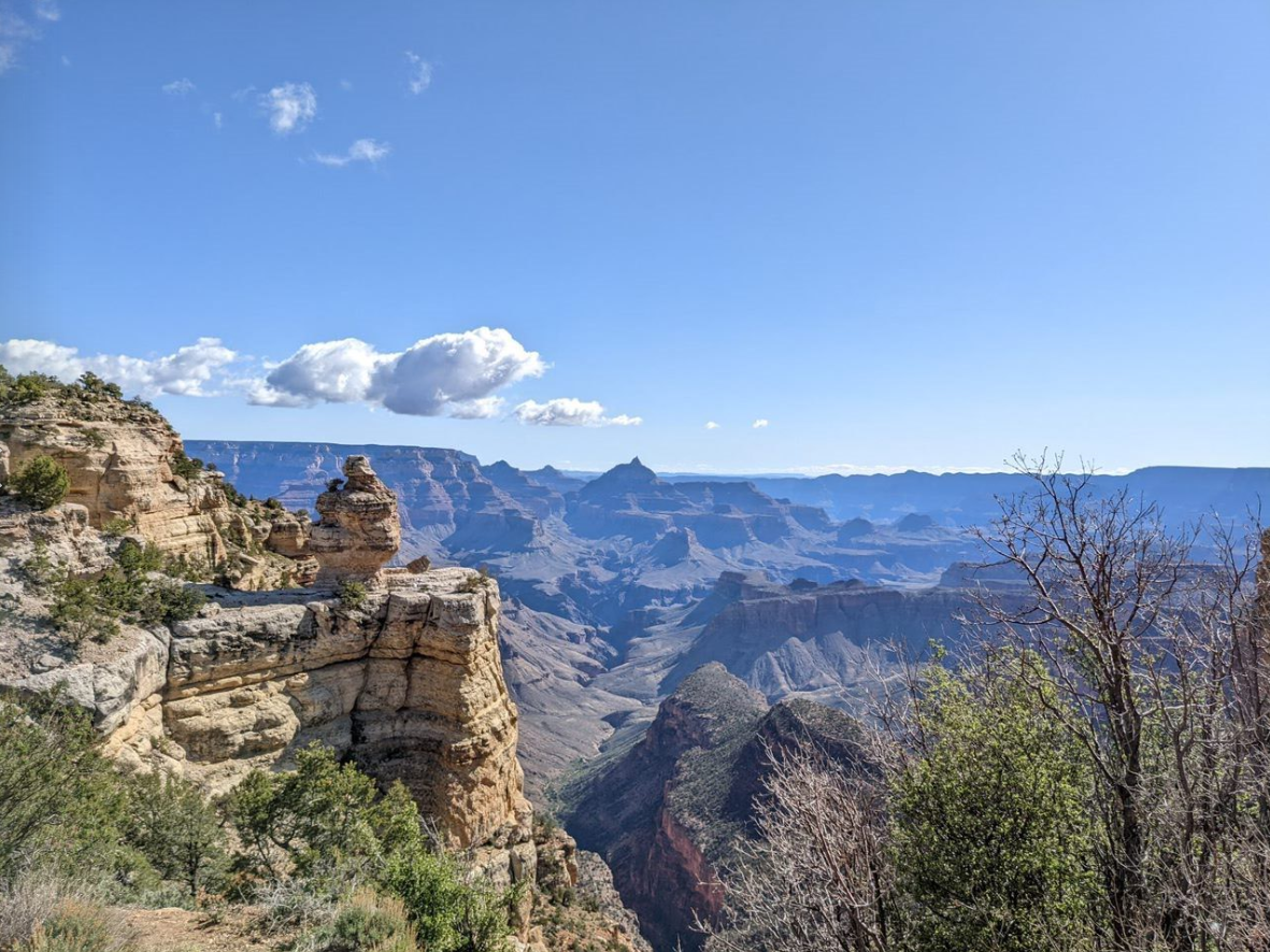
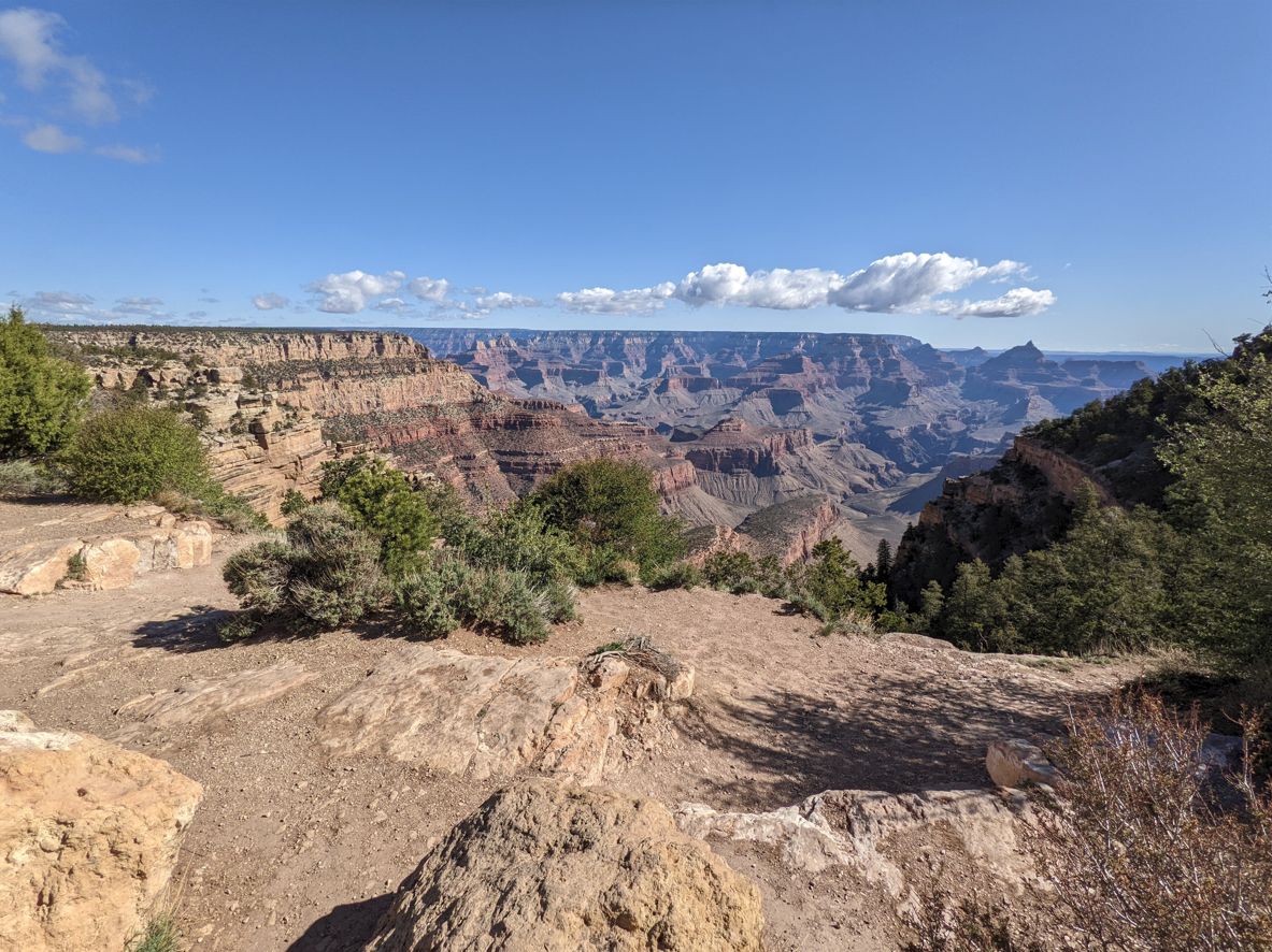
And if you haven’t guessde by now, the $35 Detour took us through Grand Canyon National Park. I have my annual park pass, so this was my first chance to use it this travel season. Later, I learned that a few of our fellow rally participants took some extra time to visit the Grand Canyon longer. Well worth it, even if they had to skip some later checkpoints in the day.
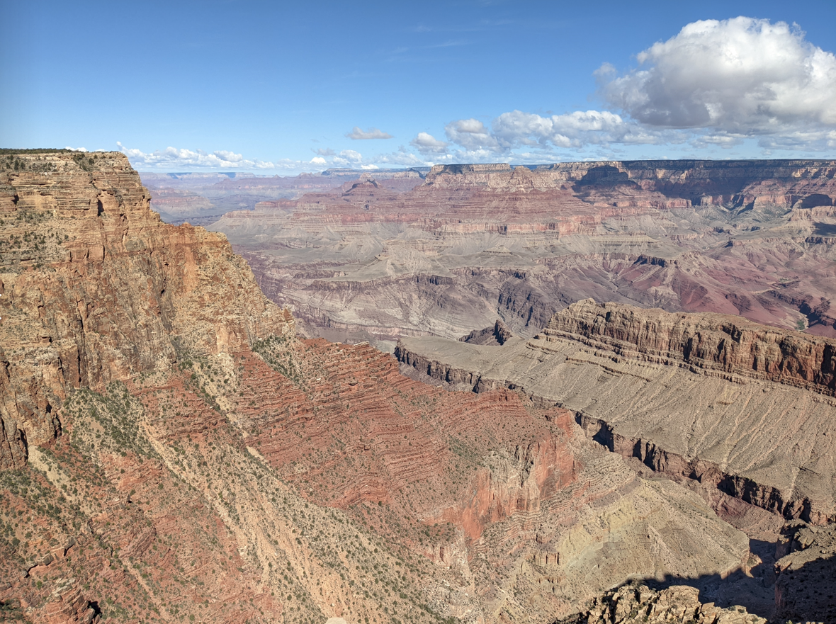
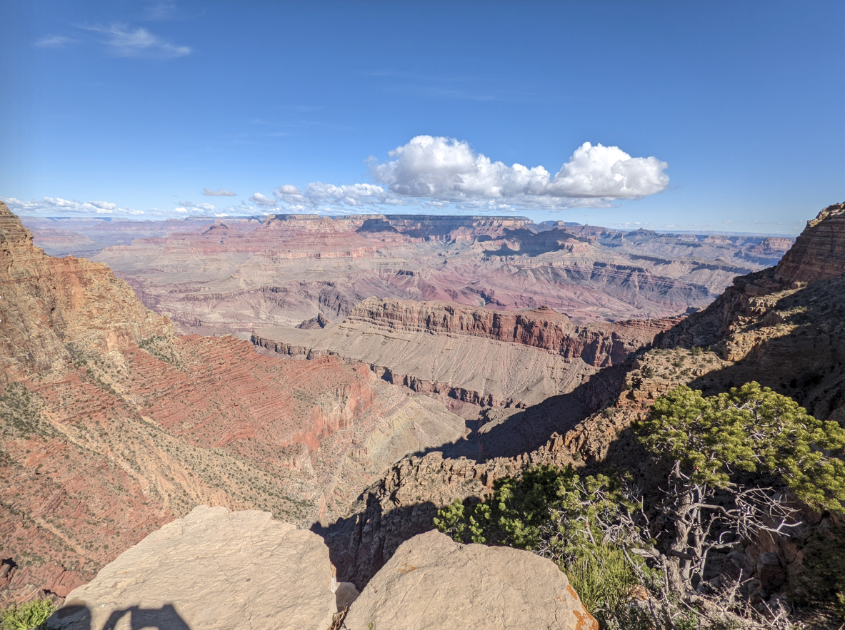
I would have stayed longer myself, but decided to forge ahead. Luckily for me, the eastern entrance/exit to the park is a route I have never taken before, and the area outside the park is every bit as scenic, in a different way.
Quite a detour! Although it did cost us some time. Normally the driving time from Flagstaff to our next checkpoint would have been about 150 miles at 2 hours, 25 minutes, but would take 4 hours, 15 minutes and 80 additional miles having to bypass the closed stretch of US-89. Taking the alternate route through Hopi and Navajo lands would have saved a half hour and 35 miles, but the route through those lands was not recommended, even if we stuck to the state roads (such as, going east on I-40 to Winslow, picking up AZ-87 and turning onto AZ-264). The Navajo Nation, in fact, still had strict COVID restrictions in place, and we were advised not to travel there.
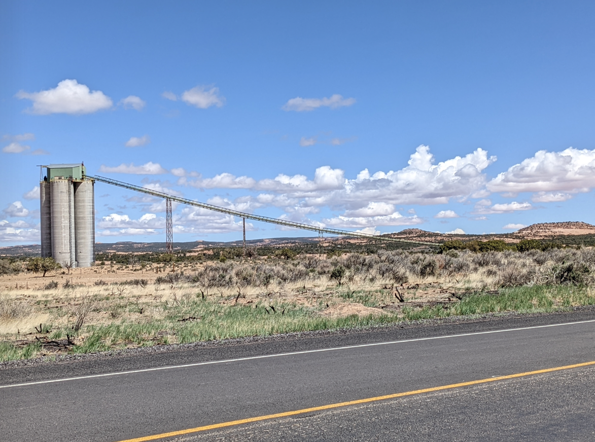
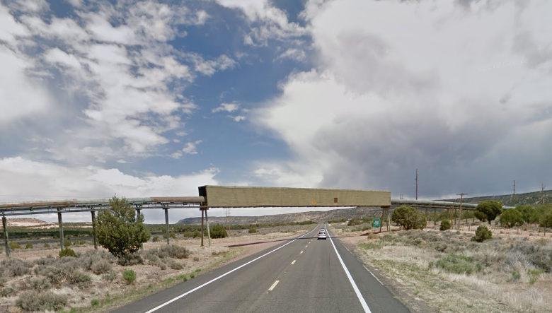
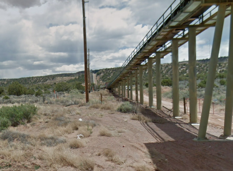
Our next checkpoint was to take a photo alongside a 17 mile long coal conveyor. These silos comprise one end of a 17 mile long coal conveyor that stretches from the Kayenta Mine to this location. This section crosses over the road, then follows the countryside until it reaches the other end at the mine. The coal was used to produce electricity at the Navajo Generation Station.
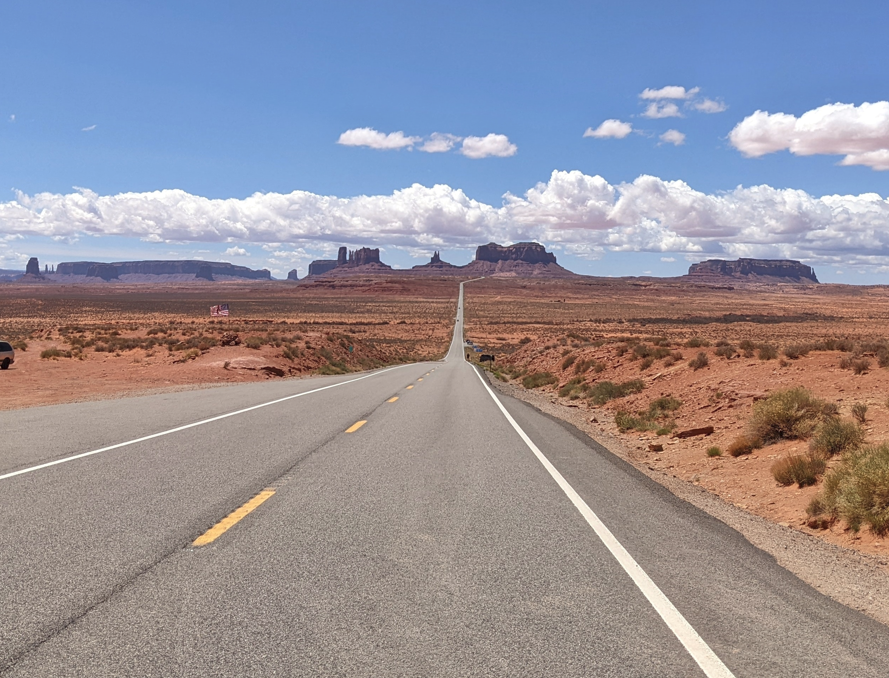
At the town of Kayenta, we turned north onto US-163. Thus began another colorful portion of the rally. This is where we would cross over the border into Utah, and drive through Monument Valley. That has been on my bucket list of places to visit in Utah. (If I’d had time, and my DSLR, I would have spent a few hours here taking photos.)
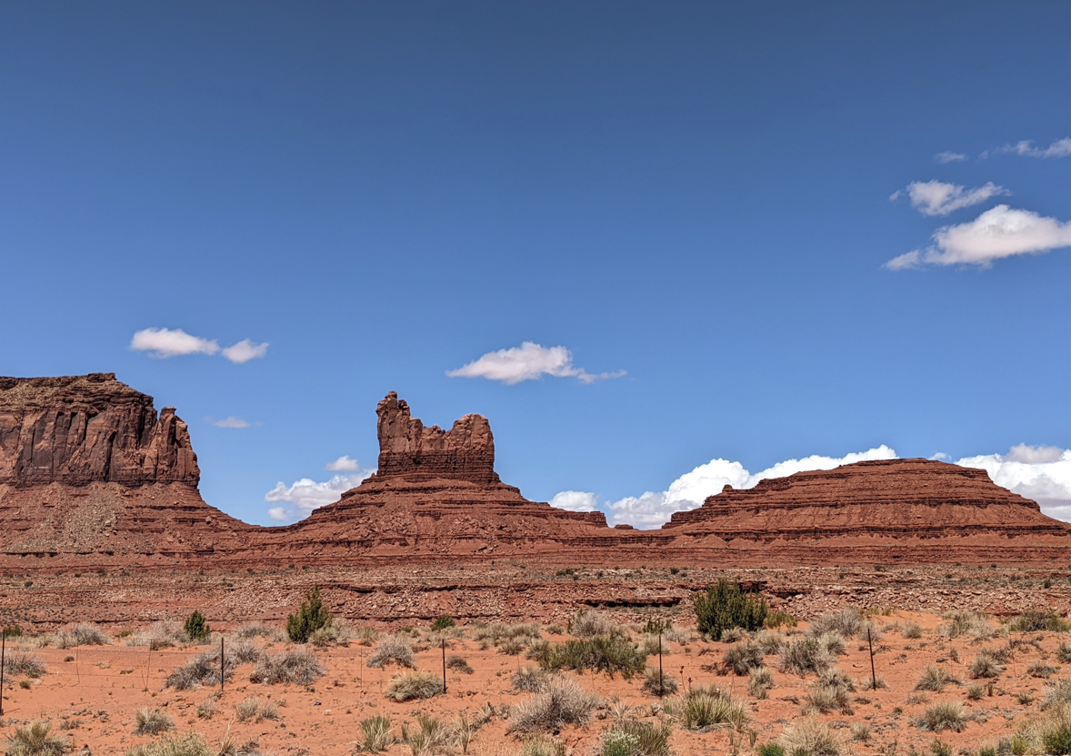
Our next checkpoint would figure prominently in this area. Not only is the location an iconic photography point for those taking pictures of Monument Valley, a major motion picture was also filmed at this location. In fact, the spot is so famous that it is immortalized on Google Maps.
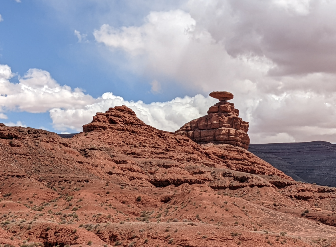
The next checkpoint was in Mexican Hat, Utah. And the town is named after this namesake rock. (Why not name it Sombrero Rock, though?)
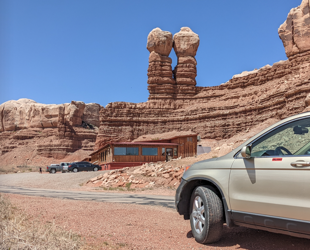
Not too far away, the next checkpoint, Twin Rocks (also known as the Navajo Twins), in Bluff, Utah. At the foot of the cliff is the Twin Rocks Café.
Just prior to Bluff, Utah, we would join US-191, which cuts through the eastern side of Utah and passes through Moab, our destination for the evening. However, the rally had other plans. In Monticello, Utah, near the Abajo Mountains, we had to locate Loyds Lake (or Lloyd’s Lake, depending on which spelling you could find–local signage pointed me towards “Loyds Lake”).
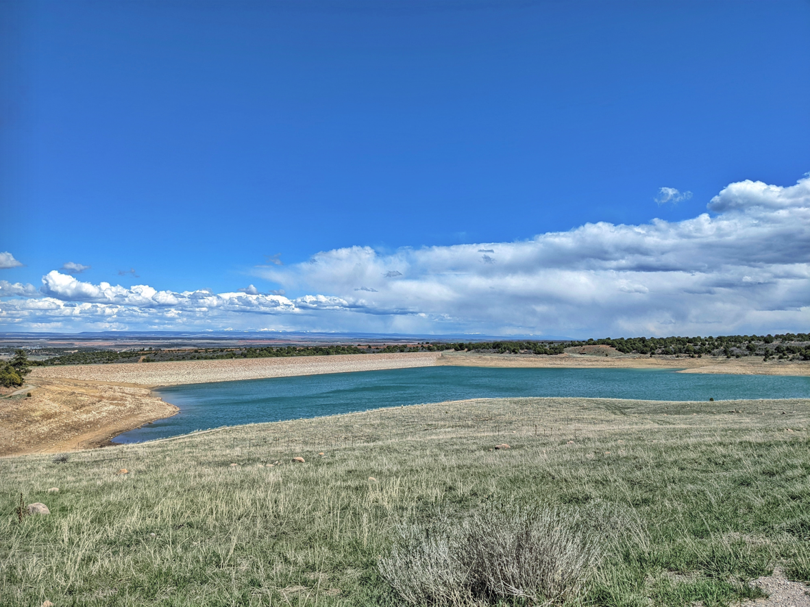
The view at Loyds Lake is typical of many Utah vistas–you can see for dozens of miles into the distance.
Time to head east…